Sunday, August 31, 2008

Weno Island, Chuuk State, Micronesia


One more traditional Micronesian dance with Weno Island, Chuuk State, Micronesia in the background.

We hear a traditional Micronesian song.


Traditional Micronesian dancers perform on the flight deck of USNS Mercy with the island of Weno, Chuuk State, Micronesia in the background.


Here's one more sunset photo from Chuuk State, Micronesia.


The flag of USNS Mercy waves softly in the breeze just before sunset in Chuuk State, Micronesia.


One of the Band-Aid boats of USNS Mercy returns to the ship at sunset in Chuuk State, Micronesia.


The moon rises over Weno Island, Chuuk State, Micronesia 23 August 2008.

Sunday, August 24, 2008

On our way to Chuuk State, Micronesia


One of the helicopters from USNS Mercy (GPS N 7 24.0160 E 151 49.3564) takes flight over Tonowas Island in Chuuk State, Micronesia.


Sunset (GPS N 5 5.7019 E 152 36.0579) the evening before we arrived in Chuuk.


Later the same evening we could see Venus and (just barely) Mercury in the western sky.


VERTREP (Vertical Replenishment) from USNS Richard E. Byrd (GPS S 7 42.8053 E 150 52.1770), a new Navy supply ship, two days after USNS Mercy left Port Moresby.


Moonrise over the Pacific, the evening after Steel Beach, from USNS Mercy.

Thursday, August 21, 2008

Leaving Port Moresby

The first sunset after leaving Port Moresby.


I wanted to get some sort of a creature carved out of wood from Papua New Guinea; this was the smallest one available the day that we were able to go to the pier for a few minutes. One of the guests on USNS Mercy told me that she recognized the pattern, that it was carved near the Sepik river in the northwest part of the country, and that it takes about two weeks to carve one of these crocodiles. I think I will name it Wewak, after a town that lies along the Sepik river.


From left to right, LTCDR Kluegel (the Director for Administration), LT Simerman (head of the Operations Department), and LT Seaman (Chief Information Officer) return to USNS Mercy aboard a Band-Aid boat from a visit to the pier in Port Moresby.


This double rainbow was so close to USNS Mercy that I could only catch half of it in the camera, on a rainy morning near Port Moresby.


Just after sunrise on a rainy day, a ship sails past the outskirts of Port Moresby.


Here's another photo of Shell, with Port Moresby and a large container ship in the background.

Papua New Guinea

The Sing Sing Dance Troupe, traditional tribal Papua New Guinea dancers, visited USNS Mercy on 15 August 2008 and performed on the flight deck.


Shell takes a look at Port Moresby from the weather deck of USNS Mercy (GPS S 9 28.0667, E 147 7.9892) on a somewhat hazy day.


Here's a closer view of downtown Port Moresby that we got a few days ago when we had the chance to visit the pier for about 45 minutes.


Sideflare 64, one of USNS Mercy's two helicopters, has just lifted off from the flight deck, with Port Moresby, the capital of Papua New Guinea, in the background.


The sun sets behind the hills to the west of Port Moresby in Papua New Guinea. The wind seems to always be blowing these clouds either toward the east or toward the west.


Here are two photos of me with Port Moresby in the background. I'm not sure which one is clearest, so I'm sending both. The wind was blowing 20 or 30 mph both days. In fact, the day I wore the striped shirt, the wind started blowing the camera off of its shelf, so I have a great close up of just my shirt as I grabbed the camera.


Many of the days here in Port Moresby have been windy, as can be seen in this photo of one of the Band-Aid boats returning to USNS Mercy; notice how the boat is bouncing up and down in the waves.

On to Port Moresby

Here's one of USNS Mercy's helicopters flying toward Port Moresby to support one of the day's missions ashore.


On 4 August 2008, USNS Mercy anchored (GPS S 9 28.0667 E 147 7.9882) just off of of Port Moresby, Papua New Guinea. This photo is of downtown Port Moresby.


Passing through the Torres Strait on 2 Aug 2008 (GPS S 10 30.1015 E 142 16.1143), and the photos show just how "strait" it is.


A ship heading west passes just to the north of USNS Mercy, and as we continue eastward we pass an island just to our south.

Lifeboat drills after leaving Darwin, Australia; Thom Pritchett, who is wearing one of his Australian hats, and IT2 Turner from the ADP department (GPS S 10 42.0771 E 133 15.2652).


One of our roommates, LCDR Andy Sallach of the US Public Health Service, took this photo of me and one of the helicopters of USNS Mercy, at flight quarters just after sunset on 2 Aug 2008 (GPS S 10 39.1445 E 139 11.0291).

Darwin, Australia

We say goodbye to Darwin, Australia.


We see a beautiful sunset as we head into the Arafura Sea (GPS S 12 11.2407, E 130 26.5013).


UNREP (Underway Replenishment) from USNS John Ericsson. In this photo, USNS Mercy has shot a line across to the John Ericsson, which will be used to bring over a heavier line and eventually the fuel lines will connect to the Mercy (GPS S 10 51.5298 E 132 21.4638).


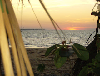
The last rays of sunset at the beach in Darwin, Australia.


In Darwin, Australia, at the beach, someone is flying a large parachute shaped kite.


An American military memorial at the park in Darwin. The plaque on the right honors 2nd LT Buel, an American fighter pilot who lost his life protecting a convoy along northern Australia in February 1942. The 4 inch gun was recovered from the USS Peary, an American destroyer that was sunk four days later at Darwin on 19 February 1942, when Darwin was attacked by Japanese bombers. (The Japanese dropped more tons of bombs on Darwin in WWII than they did on Pearl Harbor.) The gun points toward the last resting place of the Peary.


The park in Darwin Australia.


Shell checks out downtown Darwin, Australia. We weren't allowed to bring anything off the ship but ourselves when we visited Darwin, so this is as close as Shell got.